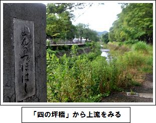
学校の西を流れる岩倉川は、淀川水系高野川の支流です。上流には田畑が広がり、中流域には岩倉実相院門跡、岩倉具視幽棲旧宅、大雲寺、山住神社などの名所旧跡があり、昔から人々にとって奥深い川だったように思います。川の水は農業用水のみならず野菜を洗ったり、日々の洗濯や水車による精米作業にも利用されてきました。
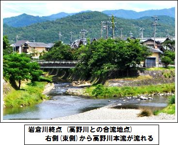
岩倉川は流れの途中、長代川などの小規模の河川と合流を繰り返し、最後は高野川に注ぎ込む地点(写真下)で岩倉川が終ります。全長約7kmです。
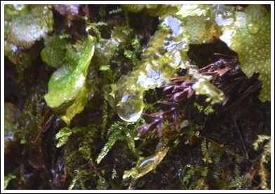
 では、その「岩倉川の最初の一滴」はどこから始まるのでしょうか。市街地の北西方向にある村松町にある「繁見坂」という解説もありますが、流路の長さからは、北東方向にある長谷町奥のほぼ東側に延びる谷の奥(柿ノ串、鎌ヶ口)のように思います。その場所で撮影した一滴が最初の写真です。こんな一滴が集まり集まって川の流れとなります。まさに「大河になる一滴」なのです。
 日頃は穏やかな岩倉川も、今から85年ほど前の1935年6月29日は、総雨量270mm(京都気象台)ほどの雨が降り、上流の池が決壊したり、牛小屋がウシもろとも流されたりと相当の被害が出たようです。その後、河川改修が進み、「天井川」とも言われた本校西側付近でも川底を深く掘り進めた結果、洪水発生の危険性がずいぶん減少しました。
ひとつの川の流路や歴史性、人の生活との関係性などに触れると、見慣れた川の見方が少し変わるのではないでしょうか。
The Iwakura River runs to the west of our school and is a tributary branch that flows into the Yodogawa River. In the upper parts of this river, there are many rice fields and the remains of historic sites, such as old homes or shrines. In the past, the river would have been a big part of the peoples’ lives, providing them with water for their agriculture and water wheels and so on.
The Iwakura River is joined by other smaller rivers along its 7km course, and it ends where it joins the Takano River.
So where is the “first drop of the Iwakura River”? It is said that it starts in the north west of the Muramatsu area, but many think it starts in a valley to the north east of the Nagatani area. The photo is the first drop at that point. Drops like this come together to form the river. This is really the start of a major river.
Even though the Iwakura River is a small river, 85 years ago on June 29th, 1935, about 270mm of rain fell and resulted in an overflow that caused floods and a lot of damage, even causing cows to be swept away. After this, deeper ceiling rivers in the area were formed to make the area safer.
By learning about the rivers around us, we can learn to see them in a different way.
《Words》 雫 drop、支流 tributary branch、名所旧跡 Historic sites、天井川 Ceiling river、洪水 flood、水車Water wheel、田んぼ rice field、農業 agriculture


